So if you're going to do any serious mapping in Tableau, there one name you have to know: Allan Walker, Tableau Zen Master of all things mapping, and Business Intelligence Analyst for Utah State University. Check out his website They Walked Together or follow him on Twitter to see some amazing mapping in Tableau.
So I've tried to figure out how to bring in aerial imagery for years, and just recently found how to do it from this post on Allan's blog. But before you can leverage that, let make sure you know how to leverage a WMS server in Tableau. Back to the SuperStore Data...
In a new workbook double click "City" and you should get a map that looks like this:

Now click on the Map menu and head to WMS Servers:

Select add and you'll put the url of the WMS in this box:

This is where you can now use either of the links that Allan provided in his blog post. I'm going to use the NAIP one as it's got better nationwide coverage. Here's the URL:
http://raster.nationalmap.gov/ArcGIS/services/Orthoimagery/USGS_EDC_Ortho_NAIP/ImageServer/WMSServer?
Once it's added, close those windows and select the Map menu again. You should now see the new WMS server map on there (if you used my link, it will have NAIP at the end). Select that new map and you should now see something like this:

Wa-la Aerial Imagery! Zoom in to get the full effect. Here's NYC:

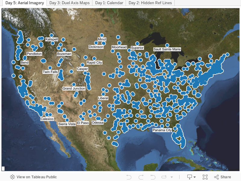
Pretty cool, huh? Y'all be sure to thank Zen Master Walker before you leave. Thanks for stopping by!
Nelson
I was going through these photographs. Glad to look at all those diverse colors and patterns. Wonderful, just wonderful. You are really a stunning photographer.
ReplyDeleteaerial photographer NSW
I actually think they are the most contextually dense data visualization that exists (so glad you asked!). That's why I love this next trick - simple, easy, and really cool. It's time for Aerial Imagery in Maps!
ReplyDeleteaerial photography salt flats
Thank you for this! Unfortunately, when I go to Background Maps, there's no "Online" option - just None, Offline and Tableau. I can click on WMS servers, but after pasting the link, the OK button is grayed out. I tried this while logging in and out. Any suggestions?
ReplyDeletehttp://raster.nationalmap.gov/ArcGIS/services/Orthoimagery/USGS_EDC_Ortho_NAIP/ImageServer/WMSServer?
ReplyDeletei.e., the link that you gave to connect to the WMS server link is not working. Error 400 HTTP bad request shows up on entering the above link.
Nice! thank you so much! Thank you for sharing. Your blog posts are more interesting and informative. flat earth
ReplyDeletenice blog , very helpful and visit us for VISUALIZATION SERVICES in UK
ReplyDelete